If you were patient enough to bear with me the long road to Ohrid and if you enjoyed the Old Town, as well as my stories, it means we’re on the right track. Today, in the third chapter of my Ohrid travel guide, we’ll talk about what it actually is the core and main reason why this small town is so charming: Lake Ohrid.

Lake Ohrid
I’ll bore you with some data related to the lake precisely to realize that this place is far from being neglectable. Included in the UNESCO heritage since 1979, lake Ohrid is one of the oldest and deepest lakes on Earth. With a maximum depth of approximately 300 metres, the lake spreads 30 km in length and 15 km in width, covering a surface of approximately 350 sq. km. Both the vast surface and the warm waters, of an intense blue, contribute to the common impression that we’re actually standing in front of a sea, and we’re not that far from the truth, as the lake is called Macedonia’s Freshwater Sea. The shore, over 80 km long, belongs to Macedonia (50 km) and Abania (30 km). Comparing it to the sea level, the lake is situated at an altitude of 700 metres. However, none of these numbers make sense or can be seen or felt when you’re looking at Lake Ohrid, whose beauty, doubled by the grandeur of Mount Galicica keeping watch over it, is impressive. Across the mountain, there’s another lake, Prespa, situated at a higher altitude, whose waters infiltrate through the soil and form a part of lake Ohrid’s springs. These springs pop out at St. Naum, giving birth to the Black Drim (or Black Drin) river which crosses the lake to flow out of it in the town of Struga (considered the lake’s mouth). From here, the Black Drim continues its route north, through Albania, all the way to the Adriatic Sea.
If you’ve made it this far, to Ohrid and Lake Orid, put aside approx 10 euro / person for the Lake Ohrid cruise, which takes you from Ohrid’s harbour to St. Naum (on the things to see and do there, in the next chapter of my Ohrid Travel Guide). Departure takes place at 10 am from the port, but if you live in one of the hotels in Sveti Stefan (near Ohrid), you can ask your guide to talk to the boat’s captain to come and pick you up from one of the piers in your area. The journey takes about an hour and a half, but you will not have time to get bored. From my own experience, I recommend you to opt for one of the places on the boat’s open deck and sunbathe, as the sun and his reflection in the water will give you a great tan (attention not to get burned – apply some sunscreen before getting on the boat!).


While the boat carries you over the clear and quiet waters of Lake Ohrid, I’ll tell you some stories about what you can see on the shores of the lake and what you can’t see in the water. Two species of fish are representative to Lake Ohrid’s waters: the Ohrid trout and the European eel. The first one is an endemic species, as this trout, which is threatened by extensive fishing, lives only in the waters of the lake. This led to the prohibition of fishing for a period of 10 years (2004-2014). Unfortunately, the law is valid and respected only in Macedonia, while the situation is different on the opposite side of the lake, in Albania. The second species of fish, the European eel, is said to be born in the waters of the Sargasso Sea (in the Atlantic Ocean) and to migrate for 300 days to Europe to find a mate. The fish enter through the Mediterranean Sea in the Ionian Sea, Adriatic Sea, Black Drim River, until they reach the waters of Lake Ohrid. It takes between 5 and 20 years for the fish to mature, find their pair and resume their journey to the Sargasso Sea, where they die after spawning.
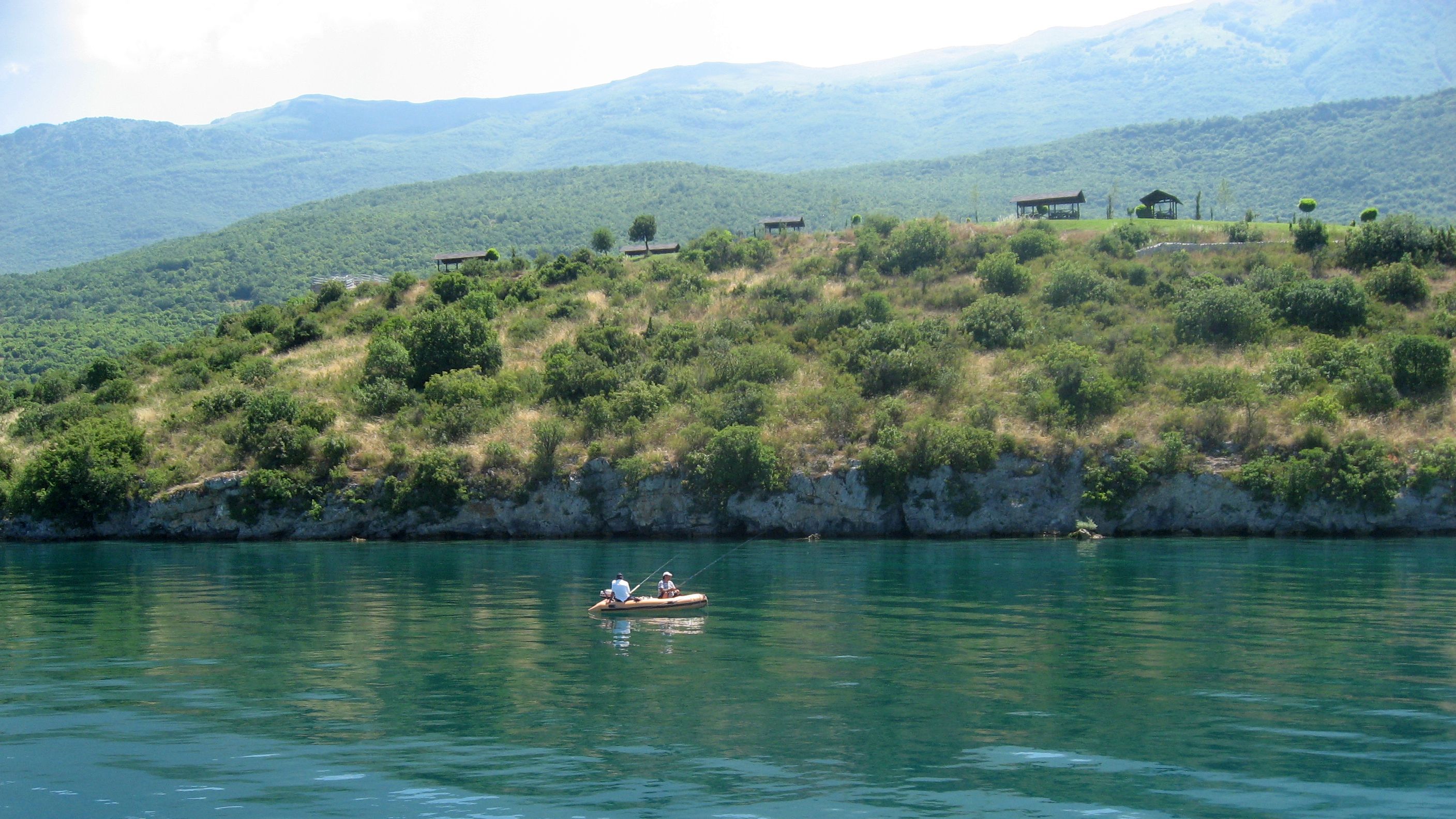
Fishing in Lake Ohrid
When we cease to scrutinize the waters of the lake hoping to see the eels living their beautiful love story, we see the gorgeous landscape of the shore of Lake Ohrid. No wonder that on a rock that rises above the water we can find the only 5 star hotel in the area, next to the summer residence of the President of Macedonia (the former holiday home of Josip Broz Tito). A few minutes later, still on the shore on the left, along which we cruise, we see another rock that requires our attention, as there we can see a replica of a military fortification (Gradiste) built there in the time of Roman domination. Immediately behind the rock we see a small bay which houses an outdoor water museum, the Bay of Bones. An exceptional archaeological complex, the museum contains a settlement of thatched adobe houses built on stilts. In the past (1200 – 700 BC), the settlement extended over an area of 8500 sqm. A family would build their house on stilts, in the water, in order to avoid attacks from predators and other tribes. As the family expanded, the number of houses would grow too and they’s be connected by platforms. In the end, a whole tribe would reside on a single, more spacious, platform. The name of the museum was given by the numerous remains of animal bones found here together with traces of human settlements, which were believed to have been used as weapons. Once we get past the Bay of Bones, the shore becomes higher, a sign that we follow the side of the protected natural park from Mount Galicica.


Close to St. Naum, when we start to see the port where we get off the boat and the border with Albania (in the distance), our attention is drawn by a small church on the shore. It’s Zaum Monastery, built in the 14th century, which can only be reached by water, by boat (you can take boat – taxis from the nearby fishermen villages of Ljubanista and Trpejca). Legend has it that no one was allowed in the past to measure Lake Ohrid. One day, a fisherman’s daughter went up to her father’s boat, tied a rope to the shore and began rowing, hoping to be able to measure the lake with that rope. When she reached the center of the lake, a wild storm arose, the rope broke and the boat was about to be crushed by the waves. Terrified, the girl began to pray for the Virgin Mary to help her and throw her ashore. On the place where the storm threw her ashore, she built a church called Zaum (literally: with / for the mind), to always remember what could have happened because she acted irresponsibly.
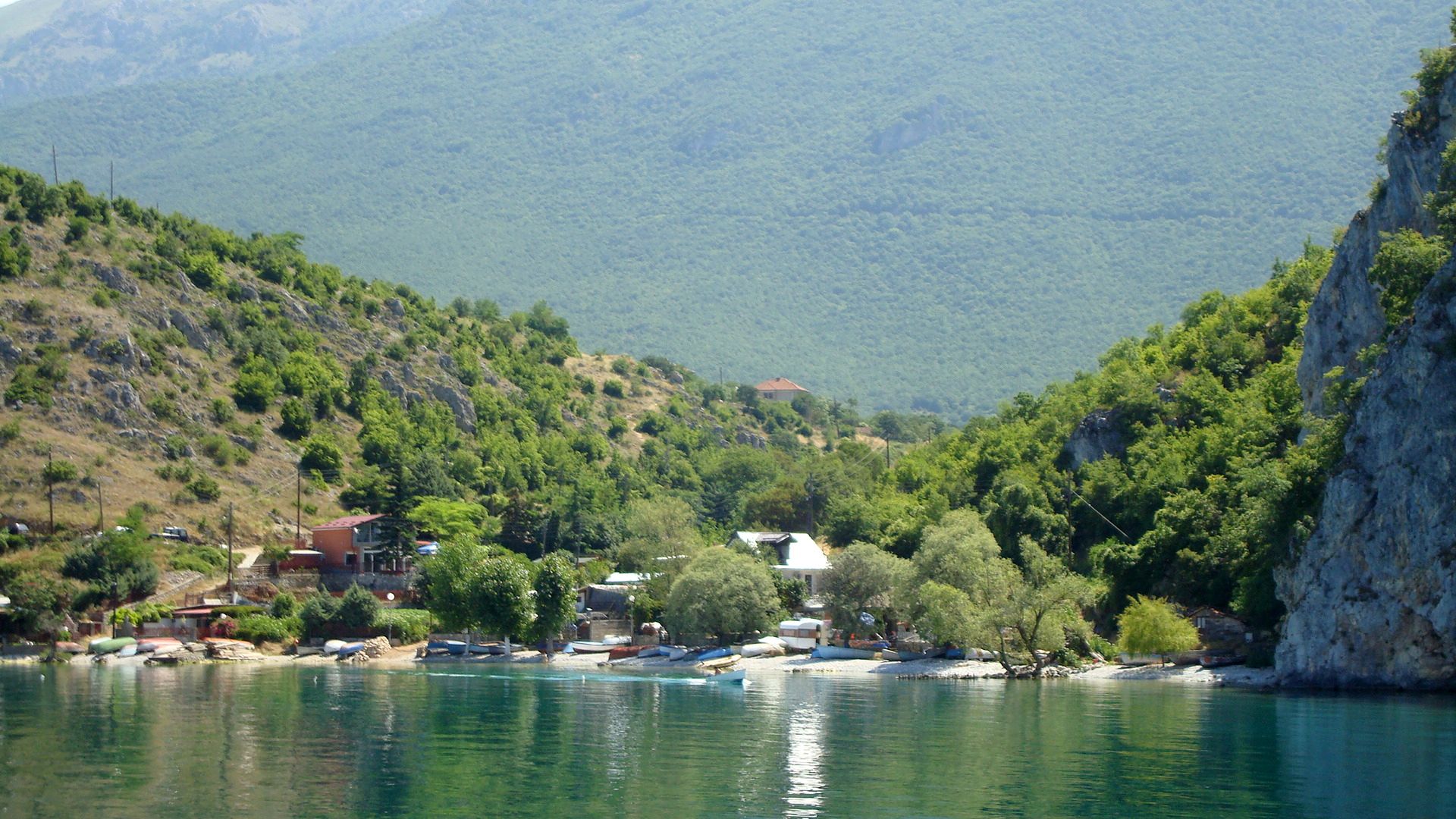
Fishermen’s village
In front of you, you will already see the St. Naum Monastery, the terminus of the cruise on the lake. Enjoy the earth underfoot and – especially – the sand on the beach! The boat will go back to Ohrid local time 16, so you have approx. 4 hours to visit the area, have lunch, do some sun tanning shopping.


More details about what you can do and visit in St. Naum, in part IV of my small travel guide! Until then, dream of Ohrid!
Other helpful articles from Ohrid Travel Guide:


Pingback: Ohrid Travel Guide. Part I: The Road | Dana's Boots
Pingback: Ohrid Travel Guide. Part II: The Old Town | Dana's Boots
Pingback: Ohrid Travel Guide. Part IV: Saint Naum | Dana's Boots